20 Days
Everest Three Passes Trek
The Everest Three Passes Trek is the ultimate Everest Adventure, combining endurance, exploration and unmatched Himalayan beauty.
18
Minimum Age
Everest, Eastern Nepal
Location
$0.00
Per Person

Overview
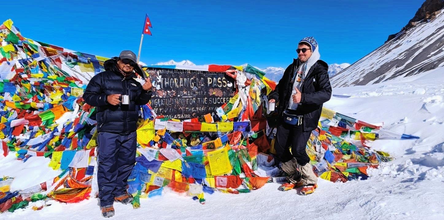
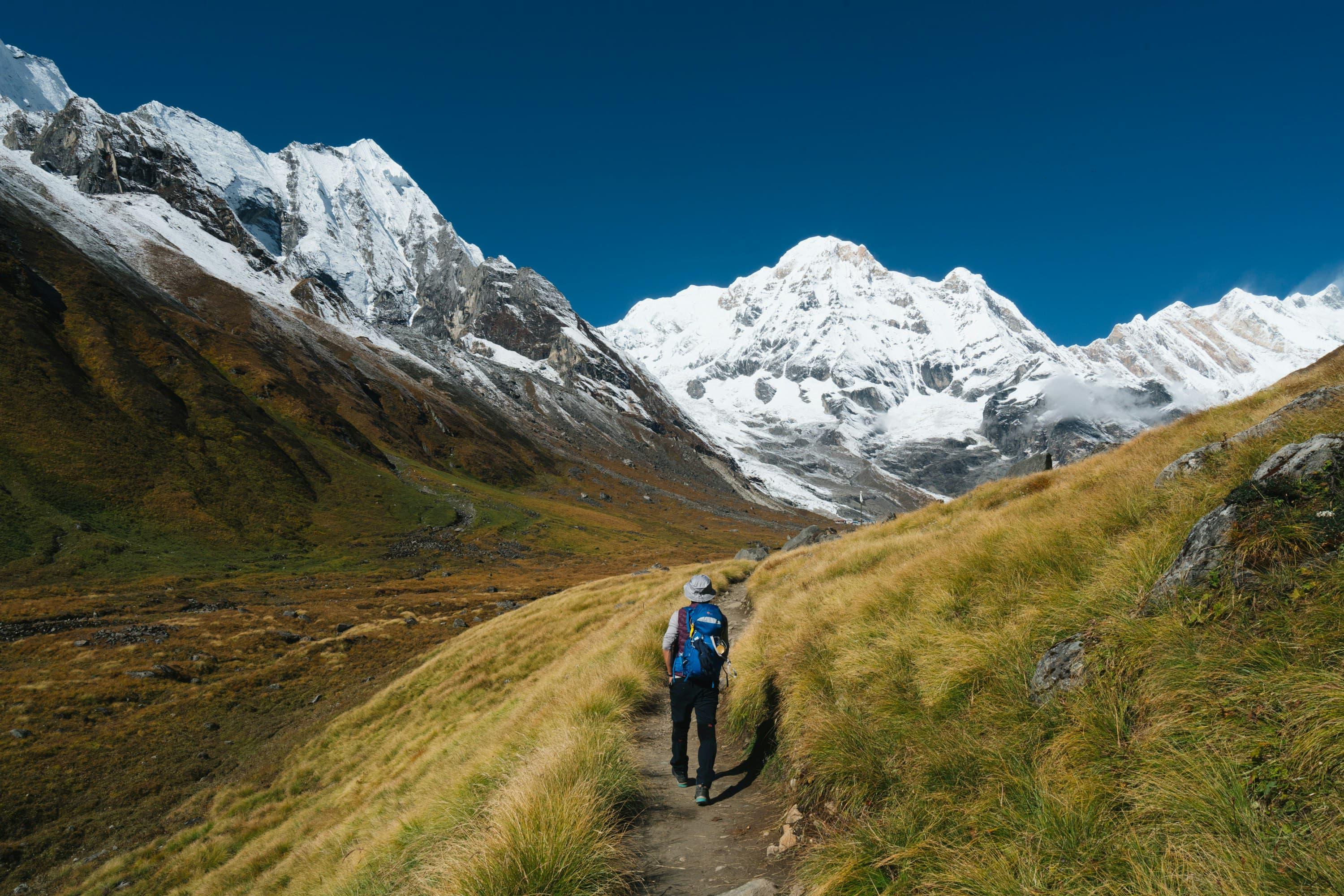
The Everest Three Passes Trek is one of the most challenging, adventurous and rewarding trekking experiences in Nepal. This ultimate Himalayan journey takes you deep into the heart of the Khumbu region, crossing three high mountain passes above 5,000 meters - Kongma La Pass(5,535m), Cho La Pass(5,420m) and Renjo La Pass(5,360m) while also visiting Everest Base Camp(5,364m), Kala Patthar(5,555m) and the stunning Gokyo Lakes.
Designed for experienced Trekkers seeking a true mountaineering-style adventure without technical climbing, this trek offers unmatched mountain scenery, physical challenge and cultural immersion in Sherpa villages.
Detailed Route Description:
The trek begins with a scenic flight from Kathmandu to Lukla, followed by gradual ascents through traditional Sherpa villages like Phakding, Namche Bazaar and Dingboche for proper acclimatization.
From Chhukung, the route crosses the first and highest pass, Kongma La Pass(5,535m), leading to the Everest Base Camp(5,364m) side of the valley. After visiting EBC and Kala Patthar(5,555m), the trek heads westward over the Cho La Pass(5,420m), linking the Everest region with the breathtaking Gokyo Valley.
After exploring the Gokyo Lakes and Gokyo Ri, the final challenge is crossing Renjo La Pass(5,360m), offering one of the best panoramic views in the Khumbu before descending through Thame and Namche Bazaar and finally returning to Lukla.
Guide & Staff Support:
a. Experienced, government-licensed trekking guide.
b. Porters(shared basis, carrying up to 20-25 kg)
c. Assistant guide for larger groups.
d. All staff insured, equipped and trained in altitude safety.
Required Permits(Included in Package):
a. Sagarmatha National Park Entry Permit.
b. Khumbu Passang Lhamu Rural Municipality Permit.
Physical Preparation & Fitness:
a. Cardiovascular training(hiking, running, cycling).
b. Leg strength and endurance exercises.
c. Practice hikes with a backpack.
d. Mental readiness for long days and altitude.
Safety & Acclimatization:
a. Proper acclimatization days included.
b. Gradual ascent strategy.
c. Guides trained in altitude sickness recognitioln and response.
d. Emergency evacuation support available(helicopter on request/insurance).
Ideal For:
a. Adventure trekkers.
b. Experienced hikers.
c. Mountain lovers seeking a complete Khumbu experience.
d. Those who want more than just Everest Base Camp.
Why Choose This Package?
The Everest Three Passes Trek is not just a trek - it's a full Himalayan expedition on foot. This package is designed to balance challenge, safety, comfort and authenticity, offering trekkers the most complete and immersive experience in the Everest region.
Trip Details
Trip Duration
20 days
Max Altitude
5555 m
Trip Difficulty
Moderate & challenging
Accommodation
Lodges and Teahouses
Best Season
Spring: March-May, Autumn: September - November
Meals
Included
Nearest Airport
Lukla
Local Transport
road transportation; bus, car, jeep, donkey, horses and flights
Everest Three Passes Trek
Day 1
Arrival In Kathmandu(1,350m)
Our team will be waiting you with garlands of marigold flowers at Tribhuvan International Airport in Kathmandu to welcome you in the land of Himalayas. After receiving you will drive to hotel in Thamel; the most popular touristic hub and will be meeting with your trek guide, will have briefing and preparations for your trek.
Day 2
Fly To Lukla(2,860m) & Trek To Phakding(2,610m)
Flight Duration: 30-40 mins Trek Distance: 8 km. Trek Duration: 3-4 hrs. Elevation Gain: +1,510m at Lukla and +1,260m at Phakding. Your adventure truly begins today with one of the most thrilling short flights in the world - a breathtaking 30 - 40 minutes journey from Kathmandu to Lukla , the gateway to the Everest region. As the plane soars above the rolling green hills and snow-capped Himalayan giants, you'll catch your first glimpses of Everest(8,848m) , Lhotse and Nuptse shimmering in the distance. Landing at famous Tenzing-Hillary Airport , perched dramatically on a Mountainside, is an adventure in itself. After meeting your porters and preparing the gear, you'll begin your trek - a gentle and scenic walk that follows the Dudh Koshi River Valley . Passing through quaint Sherpa villages, fluttering prayer flags, mani walls and lush pine forests , you'll be immersed in the rich Buddhist culture of the Khumbu region. Along the way, you can enjoy the warm hospitality of locals and the rhythmic sound of yak bells echoing along the trail. By afternoon, you'll reach the riverside village of Phakding(2,610m) - a peaceful settlement surrounded by green hills and prayer wheels. Here you'll rest for the night, acclimatize slowly and enjoy your first Himalayan sunset while savoring a warm meal by the fire.
Day 3
Trek From Phakding To Namche Bazaar(3,440m)
Trek Distance: 11 km. Trek Duration: 6-7 hrs. Elevation Gain: +830m. After a hearty mountain breakfast, your journey continues north along the Dudh Koshi River , crossing a series of suspension bridges draped with colorful prayer flags . The trail gently winds through pine and rhododendron forests, passing traditional Sherpa villages such as Manjo, Tok Tok and Benkar , where you'll enter the Sagarmatha National Park , a UNESCO World Heritage Site . From here, the path gradually descends and flat to the riverbed before you make your way across the famous Hillary Suspension Bridge , one of the Highest and most iconic bridges in the Khumbu region. Then begins a challenging uphill climb through pine forests - but every step rewards you with magnificent views of Mount Everest-8,848m, Lhotse-8,516m, Kusum Kanguru-6,367m. and Thamserku-6,608m . By afternoon, you'll arrive at the vibrant mountain town of Namche Bazaar(3,440m) - the bustling heart of the Khumbu. Surrounded by snow-covered peaks, Namche offers cozy lodges, bakeries, shops and stunning views. It's the perfect place to acclimatize, relax and experience the rich Sherpa culture that has made this region world-famous.
Day 4
Acclimatization Day In Namche Bazaar.
Today is a vital day for acclimatization , allowing your body to adjust to the higher altitude while you explore the beautiful surroundings of Namche Bazaar. After breakfast, take a scenic hike to the Everest View Hotel(3,880m) - one of the highest hotels in the world - for stunning panoramic views of the Himalayan giants; Mount Everest(8,848m), Lhotse(8,516m), Ama Dablam(6,812m), Thamserku(6,608m) and Kongde Ri(6,187m) . From the hotel, continue your walk to the traditional Khumjung Village(3,790m) - a picturesque Sherpa settlement nestled beneath the sacred Khumbila Peak(5,761m) . Here you can visit the Khumjung Monastery , said to house a legendary Yeti scalp and explore the Sir Edmund Hillary School , established by the first Everest summiteer himself. After lunch, descend back to Namche Bazaar and spend the afternoon relaxing in a cozy cafe or browsing local shops and bakeries. In the evening, enjoy the lively atmosphere of the Sherpa capital surrounded by magnificent mountain scenery.
Day 5
Trek From Namche Bazaar To Tengboche(3,860m)
Trek Distance: 10 km. Trek Duration: 5-6 hrs. Elevation Gain: +420m. After a restful night in Namche Bazaar , you set out on the trail toward Tengboche , home to the famous Tengboche Monastery . Today's trek is shorter than previous days, giving you time to soak in the surrounding scenery while continuing your acclimatization. The trail begins with a gentle climb out of Namche, passing through rhododendron and pine forests, yak pastures and charming Sherpa villages . Along the way, you can see the terraced fields where locals cultivate potatoes and barley, offering a glimpse of traditional Himalayan life . The trail is lined with prayer flags and mani walls , each one carrying blessings from generations past. As you ascend, the panoramic views become more dramatic. To the east, Amdablam(6,812m) dominates the skyline, its elegant pyramid shape framed by the deep blue sky. Behind it, the mighty peaks of Thamserku(6,623m) and Kwangde(6,450m) rise, while to the north, you catch glimpses of the upper Khumbu giants-Everest(8,848m), Lhotse(8,516m) and Nuptse(7,861m)-their snowy summits sparkling in the sunlight. Reaching Tengboche Monastery(3,870m) , you are greeted by a spiritual atmosphere that permeates the village. The monastery, perched on a ridge with panoramic views, is the largest in the Khumbu region and an important center of Tibetan Buddhism . Here, you can explore the monastery, observe afternoon prayers if you arrive early, and take in the stunning vistas of the surrounding peaks from the terrace.
Day 6
Trek From Tengboche To Dingboche(4,410m)
Trek Distance: 11 km. Trek Duration: 5-6 hrs. Elevation Gain: +550m. You leave the spiritual calm of Tengboche behind and continue your trek toward Dingboche , ascending gradually through the stunning Imja Khola Valley . Today's journey is longer and more challenging but every step rewards you with spectacular scenery and closer views of the Everest region's majestic peaks . The trail starts by descending slightly from Tengboche before climbing through forests of rhododendron, birch and juniper with occasional suspension bridges over sparkling streams . As you gain altitude, the landscape opens to wide alpine valleys dotted with stone houses and yak pastures . Throughout the day, the mountains grow ever more impressive. Ama Dablam(6,812m) remains your constant companion, while Nuptse(7,861m) and Everest(8,848m) come into view further north. You'll also see Lhotse(8,516m), Thamserku(6,623m) and Island Peak(Imja Tse, 6,189m) towering in the distance. The vast glacial valley of the Imja Khola offers a sense of grandeur as you approach Dingboche . Along the way, you pass through small villages like Pangboche and Somare , where you can observe Sherpa life, visit ancient mani walls and admire the stone stupas that dot the valley. This is also an important acclimatization stretch, preparing your body for the higher altitudes to come. Finally, you arrive in Dingboche , a serene village nestled in a wide valley, surrounded by towering peaks and glaciers. Here, you can rest, enjoy a hearty meal, and marvel at the magnificent Himalayan panorama that stretches around you.
Day 7
Acclimatization Day at Dingboche.
Hiking Distance: 6 km.(round trip) Hiking Duration: 3-4 hours. Elevation Gain: +673m. After a steady ascent to Dingboche, today is dedicated to rest and acclimatization , giving your body time to adjust to the thinner air while offering opportunities for adventure. You'll feel the crisp mountain air, the quiet of the high Himalayas and the grandeur of the surrounding peaks inspiring you with every breath. For your acclimatization hike, you can climb gently to Nangkartshang Peak(5,083m) or nearby ridges . The hike is moderate but rewarding, offering 360-degree views of Everest(8,848m), Lhotse(8,516m), Nuptse(7,861m), Ama Dablam(6,812m), Makalu(8,485m) and Island Peak(6,189m) . From these viewpoints, you'll see glaciers, icefalls and valleys that stretch endlessly, giving you a sense of the sheer scale of the region. This day also allows you to explore Dingboche village, meet Sherpa families , and observe traditional stone houses and mani walls. A visit to local teahouses lets you enjoy yak butter tea, warm meals and rest, all of which help your body adapt to the altitude .
Day 8
Trek From Dingboche To Chhukung(4,730m)
Trek Distance: 5 Km. Trek Duration: 3-4 hours. Elevation Gain: +320m. You leave Dingboche and follow a gentle gradually ascending trail that leads you deeper into the upper Imja Valley . The walk is short but incredibly scenic, giving you time to move comfortably at altitude while enjoying uninterrupted mountain views. The wide valley opens up ahead and the terrain becomes increasingly alpine, with sparse grassland, rocky paths and glacial deposits shaping the landscape. As you trek, the towering south face of Lhotse(8,516m) dominates the skyline, while Ama Dablam(6,812m) stands gracefully behind you, slowly fading into the distance. To your east, the sharp pyramid of Island Peak/Imja Tse(6,189m) comes into full view, rising dramatically above the valley floor. Glaciers spill down from the surrounding peaks, adding to the raw and powerful atmosphere of this high-mountain environment. You continue along the river, crossing gentle ridges and moraine sections with constant views of Nuptse(7,861m) and the surrounding Himalayan giants. The silence of the valley, broken only by wind and flowing water, gives you a strong sense of isolation and adventure. After a few hours of steady walking, you arrive at Chhukung(4,730m) , a small seasonal settlement set beneath the massive walls of Lhotse and Island Peak. Surrounded by glaciers and high passes, Chhukung feels remote and dramatic. Here, you rest, hydrate and prepare yourself for the challenging days ahead, as this village marks the gateway to the Kongma La Pass(5,535m) , the first of the three great passes of the Everest Three Passes Trek.
Day 9
Trek From Chhukung To Lobuche(4,940m) Via Kongma La Pass(5,535m).
Trek Distance: 12 Km. Trek Duration: 7 - 8 hours. Elevation Gain/Loss: +805m at Kongma La Pass & -595m at Lobuche. You leave Chhukung very early in the morning, knowing this will be one of the most demanding and rewarding days of the trek. The trail climbs immediately over rocky and glacial terrain as you make your way toward Kongma La Pass(5,535m) , the highest of the three Passes. The ascent is steep and physically challenging, crossing boulder fields, moraine ridges and sections of glacier where the air is thin and every step requires focus. As you gain altitude, the dramatic south face of Lhotse(8,516m) towers behind you, while Ama Dablam(6,812m) rises elegantly to the south. Ahead and to the east, the sharp peaks of Makalu(8,485m) and surrounding Himalayan giants come into view, creating an awe-inspiring panorama. The landscape feels wild and remote, with no villages, trees or signs of civilization - only rock, ice and vast Himalayan silence. Reaching the top of Kongma La Pass is a powerful moment. From the summit, you are rewarded with sweeping views of the Khumbu Glacier, frozen lakes and jagged ridgelines stretching in every direction. The sense of accomplishment is immense as you stand above 5,500 meters, surrounded by some of the world's highest mountains. From the pass, you begin a long and careful descent toward the Everest Base Camp valley. The trail drops steeply over loose rock and glacial moraine, demanding steady footing and patience. As you descend, Nuptse(7,861m) dominates the skyline, with the Khumbu Glacier flowing beneath it like a frozen river. The terrain slowly becomes more familiar as you approach Lobuche. By late afternoon, you arrive at Lobuche(4,940m) , a small high-altitude settlement set beside the glacier. Tired but deeply satisfied, you rest and recover, knowing you have conquered one of the toughest and most spectacular sections of the Everest Three Passes Trek.
Day 10
Trek From Lobuche - Gorak Shep(5,170m) - EBC(5,364m) - Gorak Shep.
Trek Distance: 15 Km. Trek Duration: 7 - 8 hours. Elevation Gain/Loss: +425m at EBC & -194m at Gorak Shep. You leave Lobuche(4,940m) and begin walking along the edge of the Khumbu Glacier , follwoing a rugged trail of rocky moraine shaped by ice and time. The path undulates gently but feels demanding at this altitude, with thin air slowing your pace. Around you, the landscape is stark and powerful - no trees, only stone, ice and towering Himalayan walls. As you move forward, Nuptse(7,861m) rises sharply on your right, its massive face dominating the skyline. Ahead, the pyramid of Pumori(7,161m) comes into view, while the distant summit of Mount Everest(8,848.86m) begins to appear above the surrounding ridges. The trail gradually leads you to Gorak Shep(5,170m) , the last permanent settlement on the Everest Base Camp route, where you stop briefly to rest and refuel. After a short break, you continue toward Everest Base Camp(5,364m) . The trail becomes more rugged as you walk directly over glacial moraine, weaving between ice formations and rocky ridges. Prayer flags flutter in the wind and the sound of shifting ice echoes through the valley. Standing at Everest Base Camp, at the foot of the world's highest mountain, is a deeply emotional moment. Surrounded by the towering peaks of Everest, Nuptse, Pumori and Lingtren(6,749m) , you truly feel the scale and power of the Himalayas. After taking time to absorb the experience, you retrace your steps back to Gorak Shep. The return walk feels quieter and more reflective, with the evening light casting dramatic shadows across the glacier. Reaching Gorak Shep again, you settle in for the night, resting your body after a long and unforgettable day in the heart of the Everest region.
Day 11
Hike To Kala Patthar(5,555m) Then Trek - Dzongla(4,830m).
Hike & Trek Distance: 13 Km. Duration: 7 - 8 hours. Elevation Gain/Loss: +385m at Kala Patthar & -725m at Dzongla. You begin your day before sunrise at Gorak Shep(5,170m) , stepping out into the cold, thin air with a headlamp lighting the rocky trail ahead. The climb to Kala Patthar(5,555m) is steep and relentless, zigzagging up a narrow ridge of loose stones. Each step feels demanding, but the growing glow in the eastern sky pulls you upward. As you gain height, the silhouettes of the world's highest mountains slowly emerge. Reaching the summit of Kala Patthar, you stand at one of the finest viewpoints in the Himalayas. Directly in front of you towers Mount Everest(8,848.86m) , closer and more dramatic than anywhere else on the trek. To the south rises Nuptse(7,861m), while Changtshe(7,543m) and Lhotse(8,516m) stretch across the horizon. To the west, Pumori(7,161m) dominates the skyline, glowing gold in the early morning light. The Khumbu gold in the early morning light. The Khumbu Glacier and Icefall lie far below, winding like a frozen river. After taking in the sunrise views and capturing unforgettable moments, you carefully descend back to Gorak Shep. The return hike feels easier as the sun warms the trail and the peaks slowly fade back into their daytime colors. Back at Gorak Shep, you enjoy a well-earned hot breakfast , rehydrating and regaining energy before continuing your journey. Leaving the Everest Base Camp route behind, you start trekking toward Dzongla(4,830m) . The trail follows the lateral moraine of the Khumbu Glacier , then gradually descends across wild and quiet landscape. As you move westward, the scenery shifts. Lobuche East(6,119m) and Taboche/Tawoche(6,542m) rise sharply ahead, while the towering north face of Ama Dablam(6,812m) comes into view in the distance. The path narrows and becomes more isolated, offering a peaceful contrast to the busy Everest Base Camp section. After crossing small glacial streams and descending rocky slopes, you finally reach the small settlement of Dzongla, tucked beneath towering cliffs and surrounded by raw alpine beauty. You end the day in Dzongla, resting in preparation for the next high pass crossing that lies ahead.
Day 12
Trek From Dzongla - Thagnak(4,700m) Via Cho La Pass(5,420m).
Trek Distance: 9 Km. Trek Duration: 6 - 7 hours. Elevation Gain/Loss: +920m at Cho La Pass & -720m at Thagnak. You leave Dzongla(4,830m) early in the morning, as this is one of the most demanding days of the Everest Three Passes Trek. The trail begins with a gradual ascent across rocky alpine terrain, moving toward the foot of the Cho La Pass(5,420m) . The air is cold and crisp and the surrounding peaks cast long shadows over the silent valley. As you climb higher, the path becomes steeper and rougher, crossing loose rocks and glacial debris. Behind you, the striking peaks of Tabuche/Tawoche(6,542m) and Cholatse(6,440m) dominate the skyline, while Ama Dablam(6,812m) appears in the distance, standing gracefully above the valley. Ahead, the route narrows and leads you noto the Cho La Glacier , where you carefully navigate icy sections, depending on conditions. Reaching the top of Cho La Pass(5,420m) is a powerful moment. Prayer flags flutter in the wind, marking the high point of the crossing. From the pass, you are rewarded with sweeping views of Cho Oyu(8,188m) to the north, while Lobuche East(6,119m) and surrounding peaks frame the dramatic glacial landscape below. The sense of achievement here is immense, as you stand between the Khumbu and Gokyo valleys. The descent from the pass is steep and technical, especially at the beginning. You carefully make you way down the rocky slopes and across icy patches, gradually leaving the rugged terrain behind. As you descend further, the trail eases and the landscape opens up, revealing wide glacial valleys carved by ancient ice. You continue trekking alongside the Ngozumpa Glacier, the longest glacier in Nepal , with its massive ice formations stretching out beside you. The route gradually flattens and the dramatic blue-gray tones of the glacier contrast beautifully with the surrounding peaks. After several hours of descent, you arrive at Thagnak(4,700m) , a small settlement set beside the glacier. You end the day in Thagnak, resting and recovering after one of the most challenging yet rewarding crossing of the entire trek.
Day 13
Trek From Thagnak To Gokyo(4,790m).
Trek Distance: 5 Km. Trek Duration: 3 - 4 hours. Elevation Gain: +90m. You leave Thagnak(4,700m) in the morning, following a relatively short but visually stunning trail along the edge of the Ngozumpa Glacier , the longest glacier in Nepal. The path is mostly gentle and undulating, allowing your body to recover after the demanding Cho La Pass crossing. Despite the easier terrain, the surroundings remain dramatic and raw. As you walk beside the glacier, you navigate across rocky moraine paths with vast ice formations stretching beside you. The landscape feels vast and open, with a sense of high-altitude wilderness. Ahead, the trail gradually reveals the shimmering turquoise waters of the Gokyo Lakes, a striking contrast to the gray and white glacial world around you. Along the way, you enjoy magnificent views of Cho Oyu(8,188m) - the world's sixth-highest mountain - rising majestically to the north. Surrounding peaks such as Kantega(6,779m) and Thamserku(6,608m) add to the dramatic skyline, while distant views of Everest(8,848.86m) and Lhotse(8,516m) occasionally appear on the horizon, depending on weather and visibility. The trail gradually ascends toward the second and third Gokyo Lakes, where the color of the water intensifies with altitude. The reflection of snow-covered peaks on the calm lake surfaces creates one of the most photogenic scenes of the entire Everest region. As you approach Gokyo Village(4,790m) , the terrain becomes smoother and the atmosphere turns peaceful and serene. You arrive in Gokyo by early afternoon, giving you time to rest, explore the lakes, or simply sit beside the water and absorb the silence of this high Himalayan sanctuary. The day feels calm and rewarding, perfectly balancing the intensity of the previous pass crossing.
Day 14
Acclimatization: Hike to Gokyo Ri(5,357m).
Hiking Distance: 3 Km. Duration: 3 - 4 hours. Elevation Gain: 567m. You spend the day in Gokyo Village(4,790m) allowing you body to rest, adapt and recover while still staying active at high altitude. Early in the morning, you set out on a rewarding hike to Gokyo Ri(5,357m) , one of the finest viewpoints in the entire Himalayas. The climb begins directly above the village and rises steeply over a well-defined trail. As you gain elevation, the thin air slows your pace, encouraging a steady rhythm. Behind you, the turquoise Gokyo Lakes gradually come into view, glowing vividly against the rocky landscape. With every step higher, the panorama expands. Reaching the summit of Gokyo Ri(5,357m) is an unforgettable moment. From the top, you are rewarded with a breathtaking 360-degree view of four of the world's highest mountains; Mount Everest(8,848.86m), Lhotse(8,516m), Makalu(8,485m) and Cho Oyu(8,188m) . Below you, the entire chain of Gokyo Lakes stretches across the valley, while the massive Ngozumpa Glacier flows beneath Cho Oyu's towering face. The silence and scale of the landscape make this one of the most powerful acclimatization experiences on the trek. After spending time at the summit, you carefully descend back to Gokyo Village, where you enjoy a well-earned breakfast. The rest of the day is relaxed and flexible. You may explore the nearby lakes, walk along the glacier, or simply rest beside the water, allowing your body to absorb the altitude gains from the morning hike. This day plays a vital role in your acclimatization, preparing you both physically and mentally for the final high pass - Renjo La - that lies ahead.
Day 15
Trek From Gokyo - Lungden(4,380m) Via Renjo La Pass(5,360m).
Trek Distance: 10 Km. Trek Duration: 6 - 7 hours. Elevation Gain/Loss: +570m. at Renjo La Pass & -980m. at Lungden. You leave Gokyo Village(4,790m) early in the morning, walking along the eastern edge of the Gokyo Lakes as the first light touches the surrounding peaks. The trail begins with a steady and gradual climb, allowing you to warm up before the ascent becomes steeper. Behind you, the turquoise waters of the lakes slowly shrink, creating a stunning contrast against the rugged, high-altitude terrain. As you gain elevation, the trail zigzags up rocky slopes toward Renjo La Pass(5,360m) , becoming steeper and more demanding. The air thins noticeably, and your pace naturally slows. When you reach the top of Renjo la Pass , prayer flags mark one of the most spectacular viewpoints of the the entire trek. From the pass, you are rewarded with a breathtaking panorama of the Gokyo Lakes spread out below, with Cho Oyu(8,188m) towering directly above the Ngozumpa Glacier . Looking east and south, you can clearly see Mount Everest(8,848.86m), Lhotse(8,516m) and Makalu(8,485m) rising above the Himalayan skyline, making this pass one of the few places where so many 8,000-meter peaks are visible at once. The sense of achievement there is immense, as you complete the final high pass of the Everest Three Passes Trek. The descent from Renjo La is long but less technical than Cho La Pass and Kongma La Pass . You carefully make your way down rocky trails into the remote Bhote Koshi Valley , passing small alpine lakes and wide yak pastures. The landscape changes quickly as you descend, becoming greener and more open. After several hours of downhill trekking, you reach Lungden(4,380m) , a quiet and peaceful settlement tucked deep in the valley near the Tibetan border. The village feels remote and authentic, offering a calm atmosphere to rest and reflect after successfully crossing all three high passes.
Day 16
Trek From Lungden - Thame(3,820m).
Trek Distance: 9 Km. Trek Duration: 5 - 6 hours. Elevation Loss: -560m. You leave Lungden(4,380m) in the morning, descending gently through the quiet and less-traveled Bhote Koshi Valley. The trail immediately feels more relaxed after the high pass crossings, allowing you to enjoy a smoother walking rhythm as the air slowly becomes richer with oxygen. As you continue downhill, you pass wide yak pastures, stone-walled fields and seasonal herder settlements. The surrounding landscape opens into broad alpine valleys framed by rugged peaks, with occasional views of Pachermo Peak(6,187m) rising above the valley. The trail follows the river, crossing small streams and wooden bridges, while prayer flags and chortens mark the spiritual character of the region. Further along, you begin to encounter traditional Sherpa villages. The influence of Tibetan culture is strong here, visible in the architecture, mani walls and fluttering prayer flags. The route remains mostly gradual, making this a comfortable trekking day and an ideal opportunity to recover after the demanding days at higher elevation. As you approach Thame(3,820m) , the valley narrows slightly and green pastures replace the stark glacial terrain above. Thame is one of the oldest Sherpa settlements in the Khumbu and is famously home to Thame Monastery , perched on a hillside above the village. The monastery offers a peaceful setting and deep insight into Sherpa Buddhist traditions. You arrive in Thame by early afternoon, leaving time to explore the monastery, walk through the village, or simply rest and reflect on the journey so far. The calm atmosphere of Thame provides a perfect transition from the high mountain wilderness back toward from the more populated trails of the Everest region.
Day 17
Trek From Thame - Namche Bazaar(3,440m).
Trek Distance: 8 Km. Trek Duration: 4 - 5 hours. Elevation Loss: -380m. You leave Thame(3,820m) after breakfast, following a well-defined trail that descends gently through the scenic Thame Valley . The walk feels comfortable and refreshing after the high-altitude passes, with improved oxygen levels and a smoother rhythm returning to your steps. The path winds past stone houses, yak pastures, mani walls and prayer wheels, reflecting the deep Buddhist traditions of the Sherpa people. As you walk, you enjoy views of surrouding peaks, including Kongde Ri(6,187m) , rising dramatically above the valley and Thamserku(6,608m) appearing in the distance on clear days. You follow the Bhote Koshi River downstream, crossing suspension bridges and passing through small villages such as Thamo, known for its nunnery and peaceful atmosphere. The trail remains mostly gradual with a few short uphill sections, making the day pleasant and less demanding. As you approach the junction near Namche, the route becomes livelier, reconnecting with the main Everest trail. A final steady climb brings you into Namche Bazaar(3,440m) , the vibrant heart of the Khumbu region. The contrast is striking-after days in remote valleys, Namche feels energetic and welcoming. You arrive in Namche by early afternoon, giving you time to relax, enjoy a hot shower, explore cafes and bakeries, or visit local markets. Returning to Namche marks a celebratory moment, as you have successfully completed all three high passes of the Everest Three Passes Trek .
Day 18
Trek From Namche Bazaar - Lukla(2,860m).
Trek Distance: 19 Km. Trek Duration: 6 - 7 hours. Elavation Loss: 580m. You leave Namche Bazaar(3,440m) after breakfast, beginning your final day on the trail. The route initially descends steeply along a stone-paved path , offering one last panoramic look at Namche and the surrounding amphitheater of mountains. As you descent, the air feels noticeably richer, and your pace becomes lighter and more relaxed. The trail follows the Dudh Koshi River , crossing high suspension bridges decorated with prayer flags and passing through dense forests of pine, rhododendron and juniper . Along the way, you walk through familiar Sherpa villages such as Monjo and Phakding , where mani walls, prayer wheels and chortens reflect the spiritual rhythm of daily life in the Khumbu. On clear days, you catch final glimpses of Kusum Kanguru(6,367m) rising sharply above the valley, while Thamserku(6,608m) and Kongde Ri(6,187m) appear intermittently through the trees. The trail includes several short ascents and descents, reminding you that the journey still demands steady effort, even on the last day. After lunch along the river, you tackle the final gentle climb toward Lukla(2,860m) . As you reach the village, a sense of accomplishment sets in-you have completed one of the most challenging and rewarding trekking routes in the Himalayas. You arrive in Lukla by afternoon, where the day is filled with reflection, gratitude and celebration. It's a time to thank your trekking team, share stories and relive the memories of crossing three high passes, standing at Everest Base Camp and witnessing some of the world's most extraordinary mountain landscapes.
Day 19
Fly From Lukla - Kathmandu(1,350m).
Flight Duration: 30 - 35 min. Elevation Loss: -1,510m. You wake up early in Lukla(2,860m) and walk to Tenzing-Hillary Airport , one of the most dramatic mountain airstrips in the world. Flights operate early in the morning when weather conditions are most stable, and you wait for the clear window that allows aircraft to depart safely from the short, sloped runway . Once airborne, the small fixed-wing aircraft climbs quickly above the valleys of the Khumbu. Through the window, you enjoy unforgettable aerial views of terraced hills, deep river gorges and the Himalayan foothills gradually giving way to greener landscapes. On clear days, you may catch final glimpses of snow-covered peaks fading into the distance as you leave the mountains behind. The flight is short but spectacular, bringing you from the remote Everest region back to the bustle of the capital. As you descend toward the Kathmandu Valley, the scenery changes dramatically-dense settlements, winding rivers and farmland spread out below. You land at Tribhuvan Domestic Airport in Kathmandu after a scenic mountain flight. The rest of the day is free to relax, enjoy a hot shower, explore Thamel, shop for souvenirs or celebrate the successful completion of the Everest Three Passes Trek with a farewell dinner.
Day 20
Final Departure; Fly Back To Home Country.
Airport transfer by a private car for your flight back home. Cherish Everest Region memories for a lifetime. Thank You Very Much for trusting & being with us.


Uncover Hidden Wilderness Together!
Often celebrated as a harmonious union of physical activity and natural exploration become an enriching journey for both body and mind.
